

")

WABBLES coming off the kind of week you don’t often see this time of year. Plenty of sunshine, comfortable temperatures combined with even more comfortable humidity? Now that’s hard to beat in mid-August! Unfortunately, it is still summer, and the dog days appear to be arriving just in time for the weekend.
Into The Weekend: Friday and Friday Night
The high pressure that’s dominated our weather for much of the week continues to push off to the east as we head into the weekend. As it does, we’ll welcome the dog days into the region.

While we’re keeping the sunshine around, we’re also bumping temperatures back up into the “warm and uncomfortable” category, with the dew points also following suit. We’re looking at a good, old-fashioned hot late-August day as highs climb back up to near 90º or so. At the same time, we’ll watch dew points soar back into the middle and upper 60s, so heat indices look to top out in the middle to upper 80s.
Clear skies will help cool us down some overnight, but not quite enough as lows look to stay put in the middle 60s overnight.
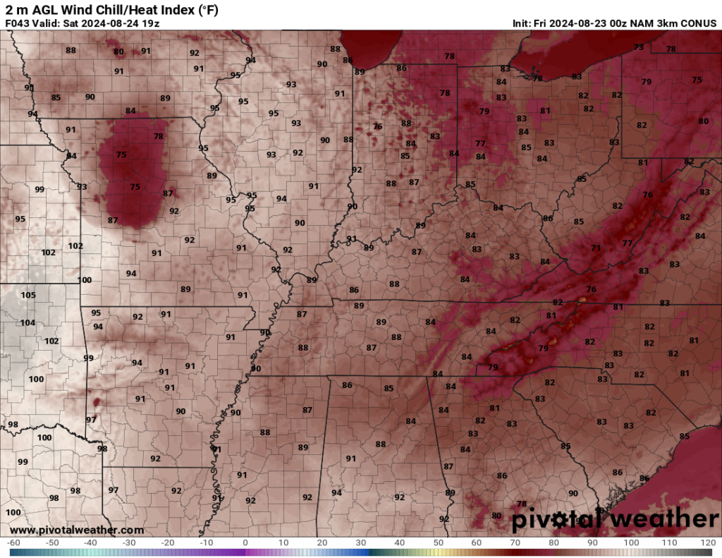
A Toasty Weekend: Saturday and Sunday
Some good looking pool days in place as we head into the weekend itself. High pressure continues to scoot off to the east, switching our winds around to the south and southwest on Saturday…and you know what that means!

Things are looking quite toasty as we head into the afternoon. Daytime highs look to climb well into the upper 80s and lower 90s as we work into our Saturday afternoon. Feels like temperatures look to crest in the middle 90s with the dew points we’ll have around. A day to stay inside with A/C, but to take those heat precautions if you need to be outside. Overnight lows stay in the middle 60s as the muggy air continues to filter into the region.
More of the same, if not a bit hotter, as we head into the day on Sunday.

Southerly winds will continue to combine with sunshine, allowing highs to balloon up into the lower to even middle 90s by the afternoon as we continue the slow return of deeper moisture into the region. This means heat indices will likely wind up between 95-100º with the mugginess in place. A/Cs will be cranking again with a lack of relief in sight, seeing as overnight lows look to hang around 70º or so.
Toward Next Week: Keeping it Toasty
The dog days are howling into WABBLES as we head for the final week of August.

Overall, the pattern doesn’t look to change much, with plenty of heat and humidity in place heading into the early parts of next week.
Now, I can’t rule out the potential for some pop-up showers and storms as we head into the afternoon hours on Monday and Tuesday as our ridge briefly breaks down. Even so, we’re still looking at very warm temperatures, with highs in the lower to middle 90s. Heat indices will be near 100º in the afternoon.

The pattern will try to shift as we head toward the end of next week. We’ll stay warm, but we may try to see an increase in showers and storms as we head toward next week. We’ll keep you posted!
That’s it for me for now! You can always keep up with the latest on all of our social media platforms. Have a tremendous day and a great weekend!