

")

We’ve noticed things getting just a tad more humid out there in WABBLES this week and it’s all ahead of more showers and thunderstorms that are heading our way as we head into the weekend.
Into the Weekend: Friday and Friday Night
You may have noticed the recent uptick in heat and humidity throughout the region as southerly flow has brought that dog days feel back into the region.
One thing we’re going to have to watch is if this relatively juicy airmass can interact with the trough moving into the region. A disturbance looks to accompany that trough that could bring us some scattered showers and thunderstorms.
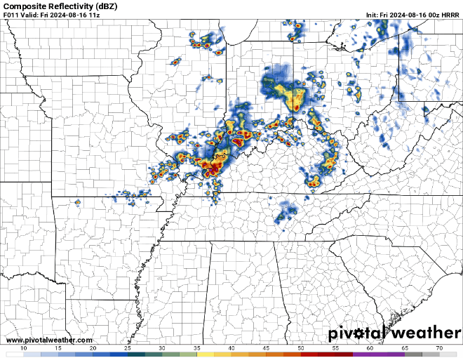
We don’t really have the ingredients in place for a lot of severe weather, but some spotty downpours and wind gusts can’t be ruled out. Outside of any storms, we’ll see mid-August-like heat and humidity in full force as highs climb into the lower 90s, especially in the afternoon. We should start to see some improvement in storm coverage overnight, but we’ll stay muggy with lows near 70º.
The Weekend: Saturday and Sunday
Said system will remain in the area as we head for the day on Saturday. Highs once again look to climb into the middle to upper 80s during the afternoon hours. As they do, we’ll watch the potential for more showers and storms to bubble up in the afternoon.
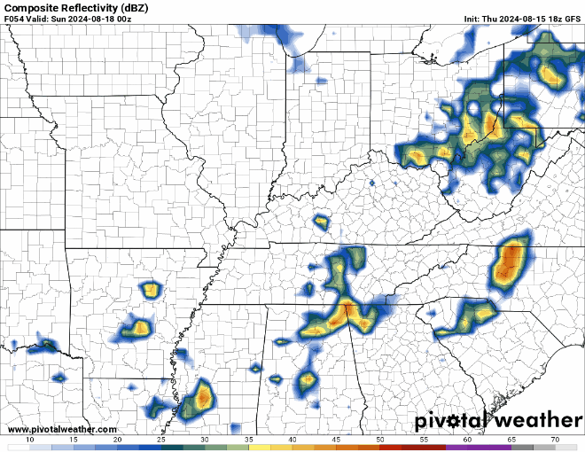
Again, severe weather doesn’t appear likely, but more intensely heavy rainfall and brief gusty winds will be a possibility. That continues even into the evening. Coverage should lessen, but a few storms will be possible overnight as lows fall back into the middle 60s.
By Sunday, our trough will be lifting out of the region, providing us with drier and, yes, even slightly less humid weather!

Highs will still be on the warmer side, peaking in the middle 80s, but overall not too bad for this time of year! We’ll also look to get a break from the recently oppressive humidity as well, with dew points falling back into the middle 60s. I mean, it won’t quite be like last weekend, but still more comfortable air greets us!

Heading into the overnight hours, we’ll still see some slightly more comfortable air, with lows back into the middle 60s under mostly clear skies.
Improving again next week
Things continue to look up as we head into the early parts of next week!

High pressure settles back into the region as we head into the early parts of next week. That not only keeps the sky sunny, but also keeps temperatures AND humidity levels comfortable!
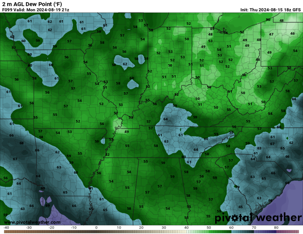
It will be warm on Monday, don’t get me wrong, but reasonably so, with sunshine driving highs up into the middle 80s. Dew points will stay in the upper 50s and lower 60s, though, keeping things relatively comfortable.
More of the same as we head through the middle of the week, with temperatures topping out in the middle 80s on Tuesday and Wednesday afternoons. Dew points hold steady in the 60s, as do overnight lows in the lower to middle 60s. We’ll watch the potential for more scattered showers and storms as we head into the later parts of next week.
That’s it for me for now! You can always keep up with the latest on all of our social media platforms. Have a tremendous day and a great weekend!