Good morning WABBLES!! Hopefully, everyone has had a wonderful holiday season but now it is back to your regular scheduled programming. It has been quiet and cold for our region this week but that is about to change with an incoming active pattern. For the students, enjoy the break until it is time to head back to class. For the rest of us, we will see how this weather will affect the first weekend of the year. Keep your jackets and umbrellas on standby. Your weekend starts now.

Always to the start the morning right. (GIPHY)
Friday
Today will be slightly warmer than previous days with light winds coming out of the southeast. This warm wind will bring our highs for the day into the 40s with partly sunny skies as cloud cover increases throughout the day. As we head into the evening hours, our skies will be mostly cloudy with lows in the 30s. Light winds shift from southwest to east with a slight chance of showers that will increase as we head into the overnight hours. Keep an umbrella ready for late night adventures as the active weather moves in.
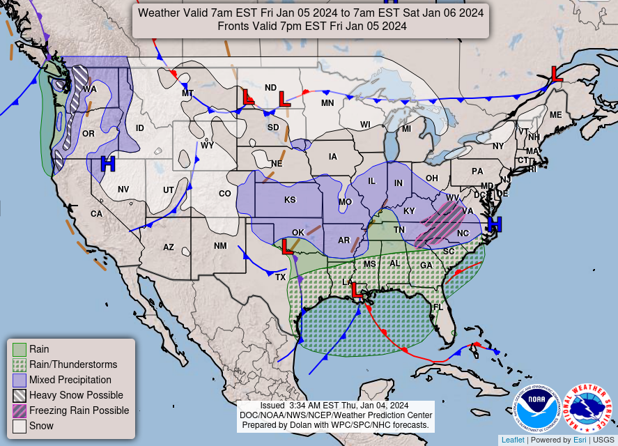
A few residents may see a snowflake or two before rain showers move in. (WPC)
Saturday
Active skies will kick off Saturday morning with rain so drive safe and have the umbrellas in hand for morning errands. Cloudy skies for us with the light eastern winds shifting west as this system moves through our region. Highs will remain in the 40s with the wind shift as rain chances remain high as we head through the day. Frequency of showers decease during the evening hours as lows in the region fall into the 30s. The overnight skies will remain active with cloudy conditions with a significant drop in shower chances. Some of us could see up to a half an inch of rain.
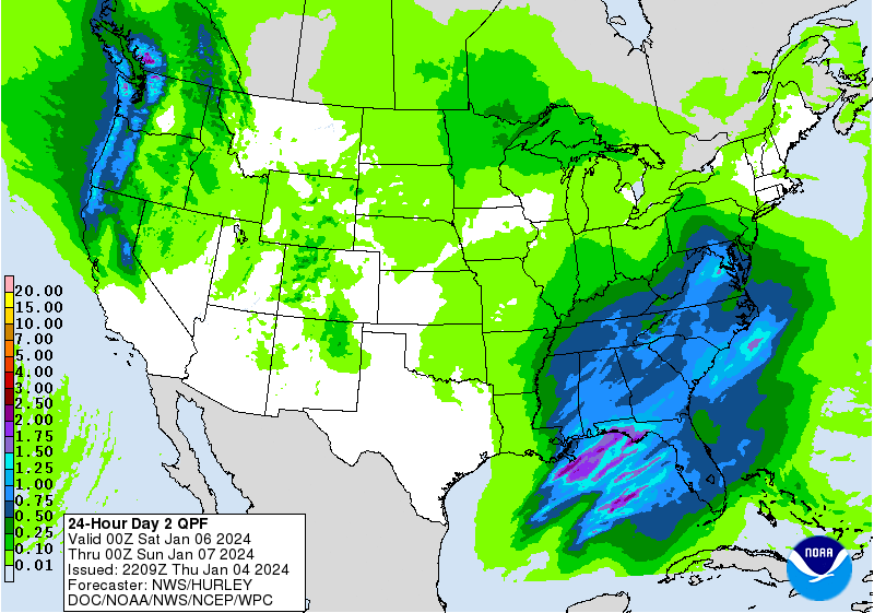
a few areas may see more than half an inch of rain. (WPC)
Sunday
As the active system moves out of our region, we have a slight chance of showers for our morning hours. Mostly cloudy skies and highs in the 40s for us as cloud cover starts to decrease during the afternoon hours. Heading into the evening hours with the decreased cloud cover gives us partly cloudy skies with chilly lows in the 20s for our overnight hours. This will give us a calm and relaxing Sunday night as we head into the next work week with another system on the way.
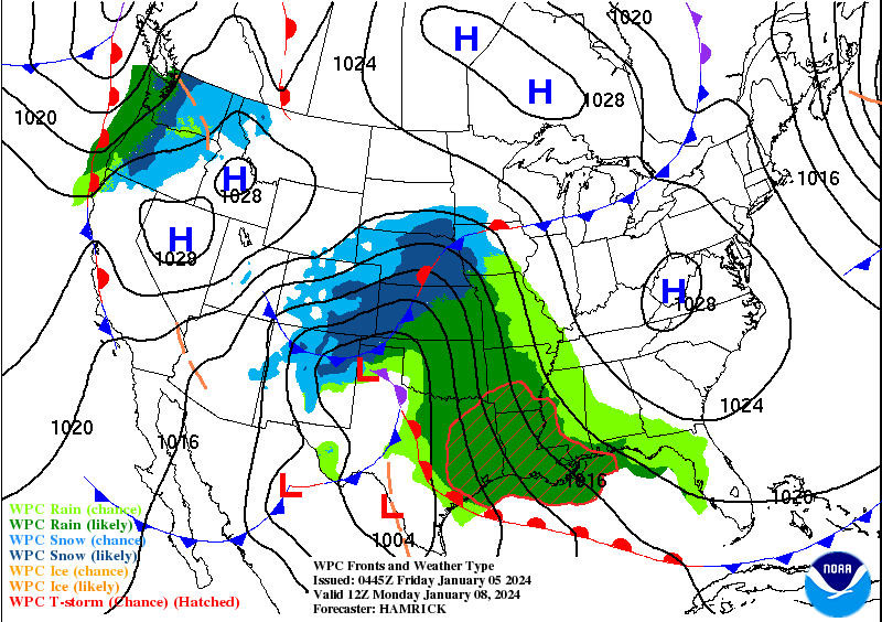
Looking at the next potential rain maker for our region this week. (WPC)
This wraps up our first weekend forecast for the year. Watch out for low areas in the road with potential for rain this weekend. This may be the first of many systems passing through our region during this active pattern so stay on your toes and we will keep you updated as winter starts to hit the gas pedal. As for the students, get ready for the spring semester is on the horizon for us. Enjoy yourselves and remember, stay classy WABBLES.
Get weekend to catch up on some reading. (GIPHY)
