

")
Good morning and happy end of the week, WABBLES! The rain from yesterday has cleared and we can now expect chilly temperatures, along with clear skies. Real fall temperatures are finally here!
Fall Finally Here
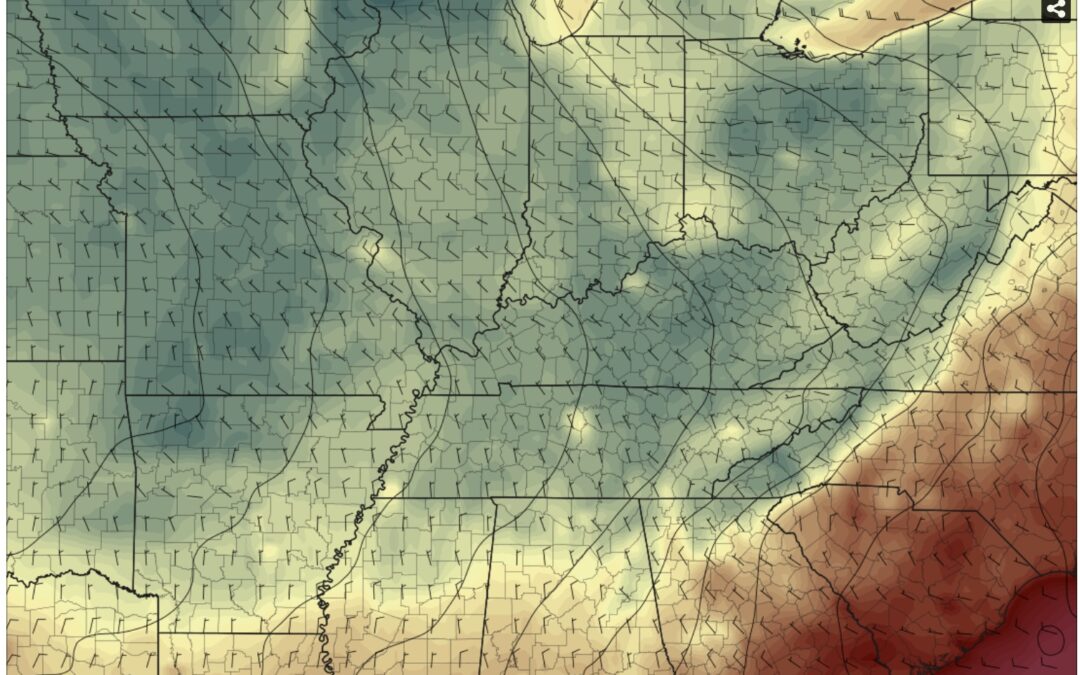
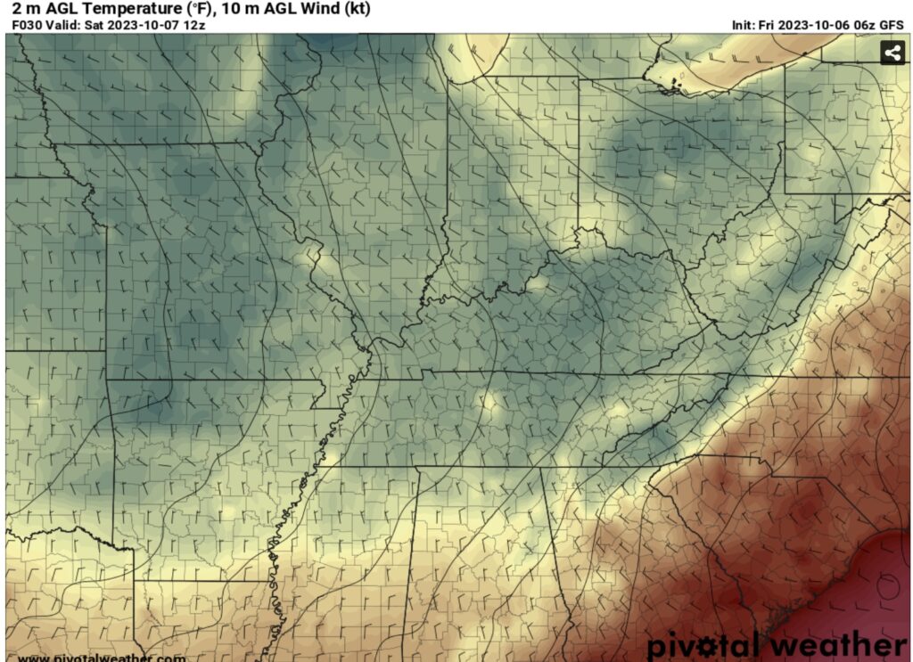
Since the first “official” day of fall, we have experienced pretty warm temperatures with highs in the upper 80’s, and lows in the 70’s. Finally we can see these start to dissipate and with the passing cold front from yesterday. High pressure is starting to settle in, with this morning’s fog appearing and skies beginning to clear.
Chilly, Yet Sunny Saturday
Saturday we can expect some of the lowest temperatures possible, wit lows being as possible as the high 30’s! Lately low temps have been in the upper 60’s, with yesterday’s low being 64. However, not only the low’s will be chilly, but the high Saturday is only expected to be near 62. With the cold frontal passage from Thursday, the coldest temperatures typically hit 24-48 hours afterwards, so this lines up perfectly.
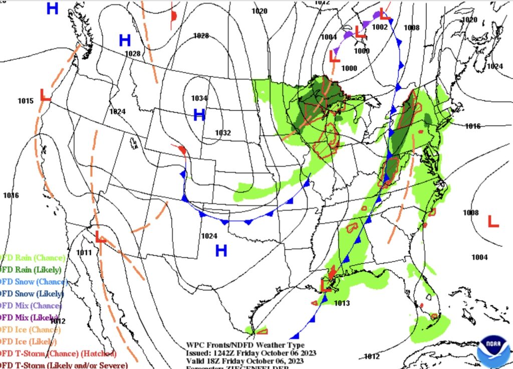
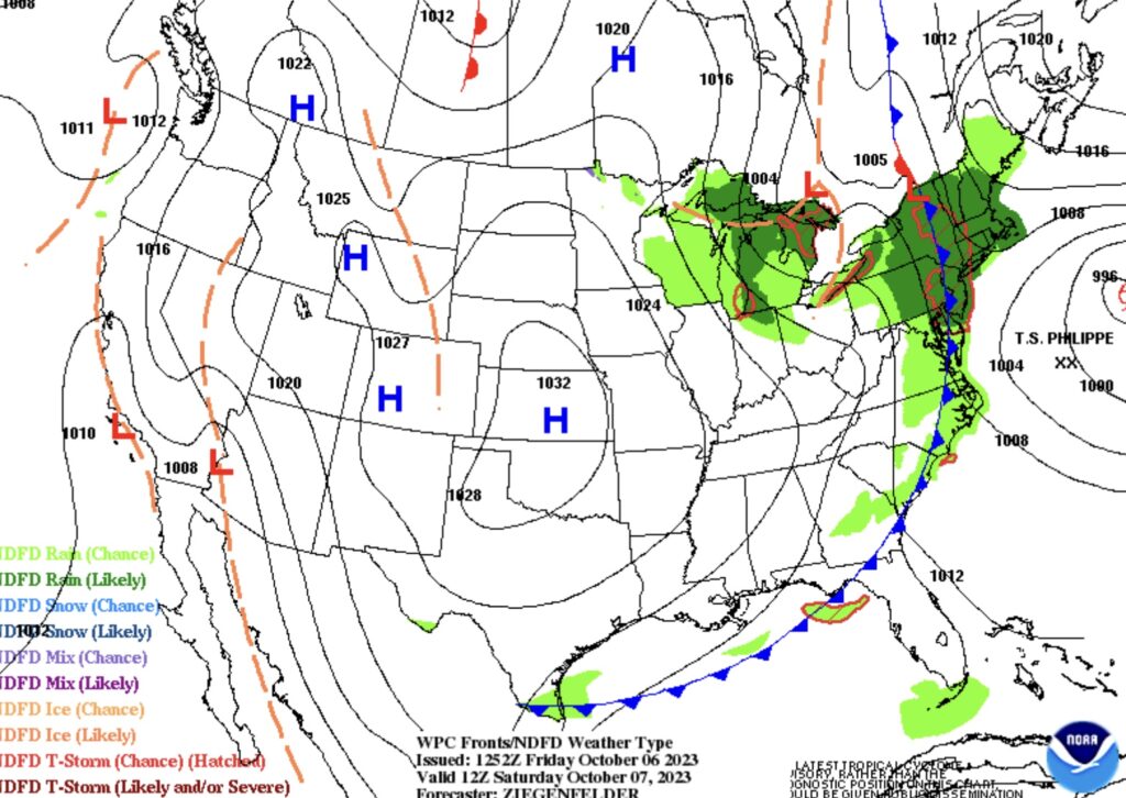
High Pressure DOminates The US
Throughout the weekend and into the start of next week high pressure will cover a majority of the United States, bringing colder temperatures to a large area, and stable weather as well. We can expect WABBLES to be fairly nice until Monday, where a low will bring us rain chances. Up until then, expect nice fall-like weather, so visit that pumpkin and go to Jackson’s Orchard maybe!
That’s all for today WABBLES! Not much to expect the next few days, so have a great weekend! As always, don’t forget to follow our social media pages to receive the most recent weather updates.
