")
We’re finally about to get a break from that pesky omega block we’ve been discussing over the past several days. Legit rain chances are finally making an appearance in the forecast, along with severe storm potential to boot. While the heat is cranking up today into tomorrow, we’ll experience light winds, providing a bit of relief. An annoyance will continue across WABBLES in the form of haze from that relentless wildfire smoke.

Entering the dog days of summer (GIPHY)
Hazy Friday
The name of the game is haze for the WABBLES region as we complete the work week. Widespread haze will blanket the skies today, as thermometers soar to the low 80s. With winds out of the north, this haze could present air quality hazards. The skies will clear up for the overnight hours, with radiational cooling allowing temps to fall into the upper 40s/low 50s.

Welcome to Hazy Town (GIPHY)
Average Saturday
High pressure will keep sunny skies in place as we start the weekend. Temps soar into the upper 80s, thanks to winds turning out of the south.
That dreaded wildfire smoke will finally start to pull to the east, bringing at least some relief from the hazy conditions that’ve overstayed their welcome.
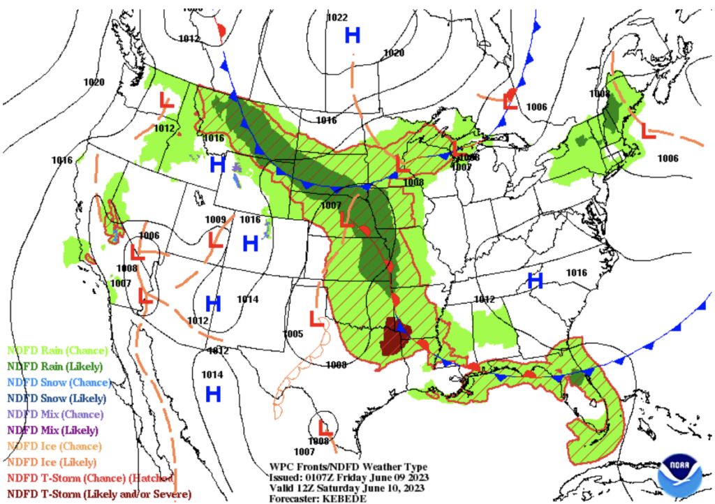
High pressure keeps the rain at bay (WPC)
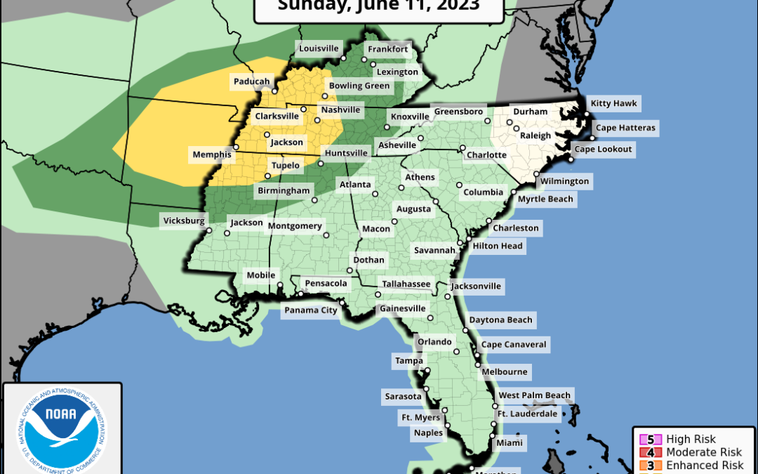
Sunday Severe Threat
Low pressure will be deepening as it moves into the area, sliding just north of WABBLES. This will escort in an associated cold front, that will serve as the triggering mechanism for strong and severe storms chances.
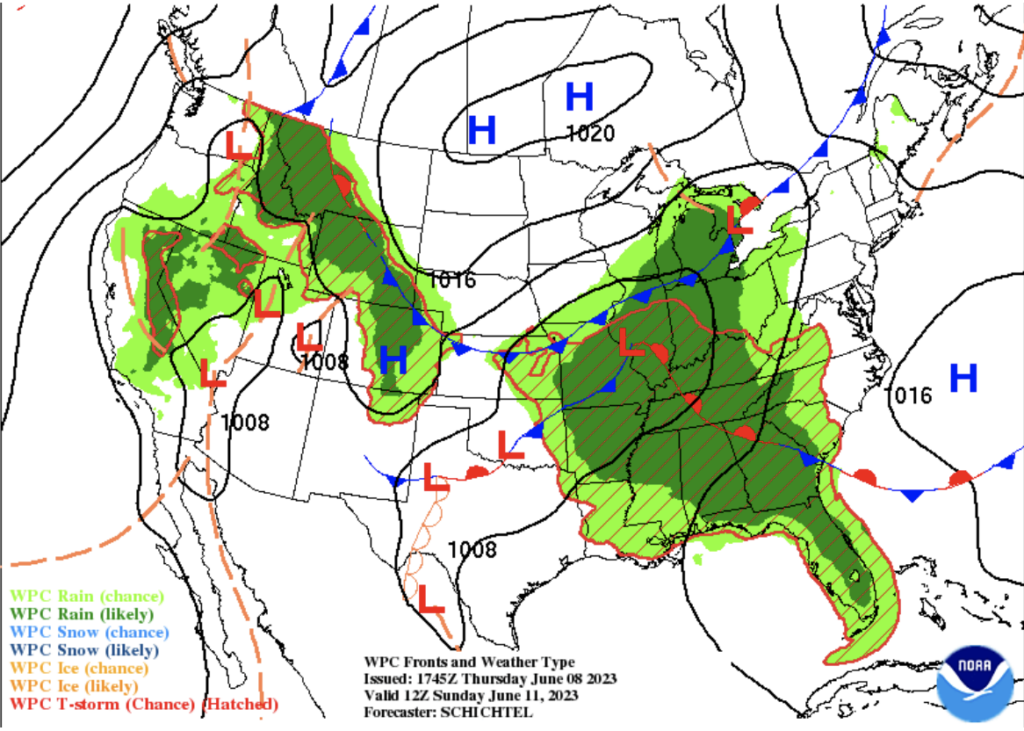
Warm rains for the end of the Weekend (WPC)
All severe weather modes will be on the table for this event. Our highest threats appear to be damaging winds and hail, with a low, but non-zero threat of a tornado spin up.
Guidance is also suggesting the potential for flooding, hinting at the possibility of cells “training” along the front, producing heavy rain rates. The latest excessive rainfall outlook brings the upgraded threat right along the KY/TN state line. We’ll need to keep a close eye on this.
As far as timing, Sunday afternoon into Sunday night is what we’re currently turning our attention to. Stay weather aware throughout the final day of the weekend. As always, we’ll be frequently updating via our social outlets with the latest.
That concludes our weekend forecast. From hazy skies to waves of rain and severe storm potential, Mother Nature will definitely be keeping us on our toes. Plan accordingly for your weekend. Until next time, stay classy WABBLES.